The project highlights the development and integration of a powerful API designed for storing and analyzing data from both CSV files and NetCDF (.nc) files. This API facilitates seamless processing, retrieval, and advanced analysis of large-scale geospatial and temporal data, enabling businesses and organizations to make data-driven decisions efficiently. The API was developed using Java 21+, Spring Boot and MongoDB.
The project required handling diverse data formats, such as CSV and NetCDF, ensuring compatibility and scalability for large datasets. Challenges included parsing complex geospatial data, optimizing performance for high-volume queries, and ensuring robust error handling.
The implementation need to meet tight deadlines, adhere to budget constraints, and seamlessly integrate into existing client systems without disrupting ongoing operations.
We developed a robust API capable of parsing and analyzing both CSV and NetCDF files. The API supports high-precision filtering, pagination, and retrieval of geospatial and temporal data.
The API efficiently stores parsed data in an SQL database, enabling users to query and analyze them using various parameters, such as timestamps, geospatial ranges, or specific metadata fields.
The API is designed for seamless integration with client systems, ensuring minimal disruption and maximum compatibility. This allows organizations to utilize their existing workflows while leveraging new analytical capabilities.
By implementing this API, clients achieved significant efficiency improvements in data processing and analysis. Key results include:
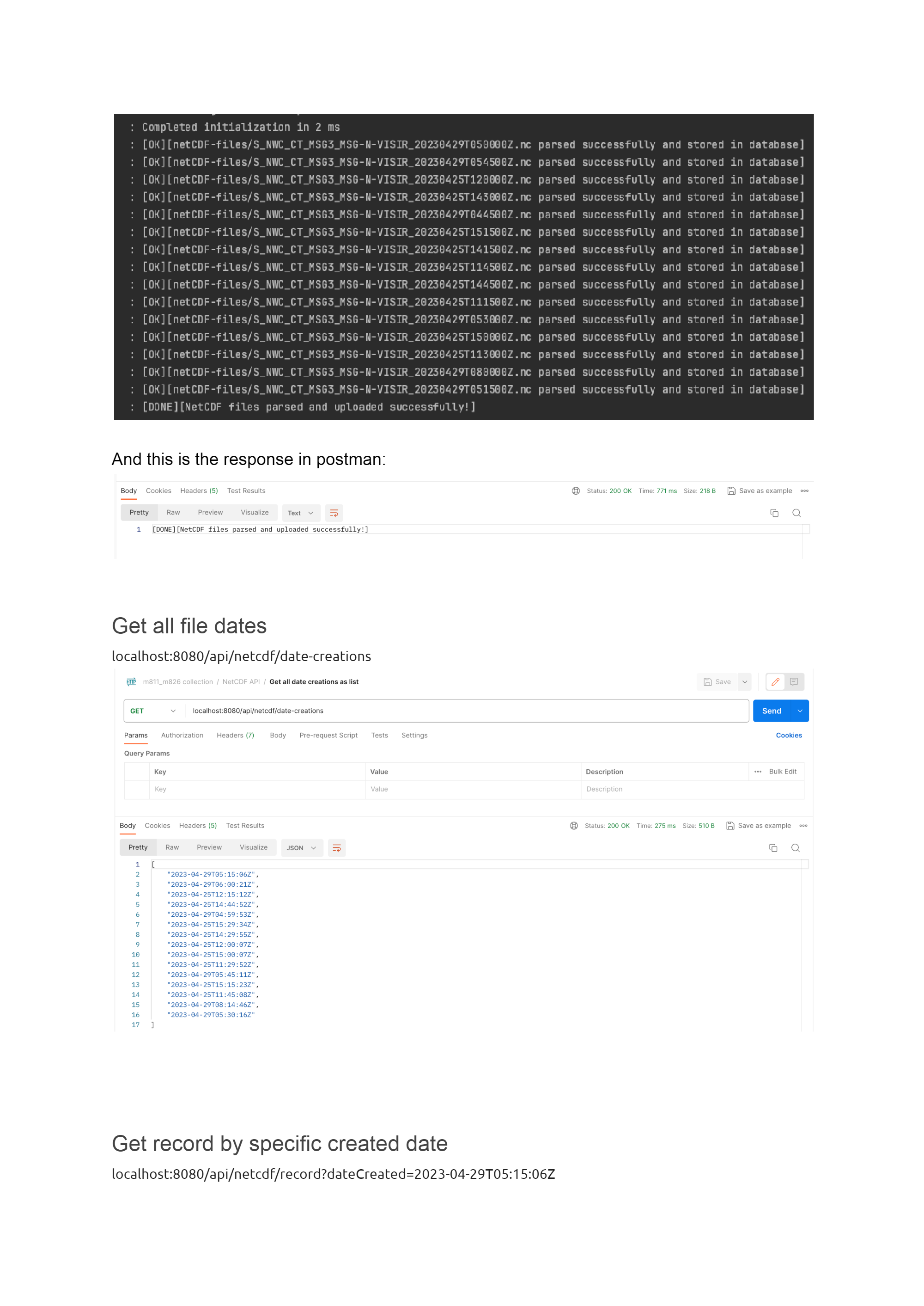
The API includes the following endpoints for CSV and NetCDF data: